

Specialized Aerial Solutions
Actionable Data for Complex Operations. Advanced aerial imaging for Oklahoma’s agriculture, construction, and infrastructure sectors. We turn visual data into operational efficiency.
Agriculture & Land Management
Protect Your Yield. Optimize Your Pasture. Farming and ranching in Oklahoma is a game of margins. Cross Drones provides the aerial intelligence you need to monitor crop health, assess pasture conditions, and manage livestock without the manual labor.
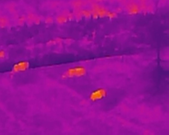
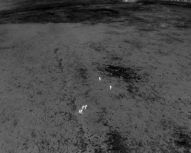
The "Invisible" Insight (Thermal Analysis): Our advanced thermal sensors see what the naked eye cannot.
Irrigation Audits: Instantly identify leaks, blockages, or dry zones in your irrigation systems before they damage your yield.
Plant Health Monitoring: Detect crop stress and disease vectors early, allowing for targeted treatment rather than blanket spraying.
Livestock Recovery: Locate herd positions in dense brush or large acreage quickly, day or night.
Pasture & Land Management:
Grazing Optimization: Map pasture density to make informed decisions on herd rotation.
Water Management: Analyze drainage patterns to prevent erosion and optimize water retention.
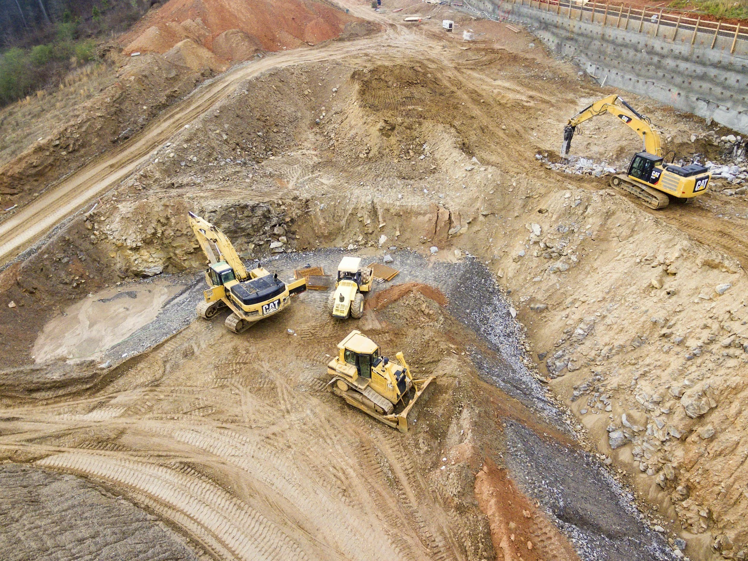
Construction & Infrastructure
Keep Your Project on Track and On Budget. From ground-breaking to ribbon-cutting, Cross Drones provides the documentation project managers need to validate timelines, report to stakeholders, and mitigate liability.
Progress Monitoring: A project schedule is only as good as its verification. We provide recurring aerial site visits (weekly/monthly) to create an irrefutable timeline of progress.
Stakeholder Reporting: Keep investors and off-site owners informed with high-resolution overhead maps and flyovers.
Subcontractor Accountability: Visually verify that materials are on-site and phases are completed before releasing payments.
Site Safety & Logistics:
Pre-Construction Planning: High-resolution orthomosaics help you plan site access, material staging, and perimeter fencing.
Inspection & Safety: Inspect roofs, towers, and hard-to-reach infrastructure without putting a single worker on a ladder.
The Process (Why Choose Us?)
The Cross Drones Commitment
FAA Certified: Fully licensed Part 107 pilots ensuring compliance with all federal airspace regulations.
Insured Operations: We carry professional liability insurance for every flight, giving you peace of mind on active job sites.
Data Delivery: We don’t just hand you a memory card. We process the data and deliver actionable files (maps, reports, visuals) that you can use immediately.
Ready to Optimize Your Operation?
Every site is unique. Contact us for a custom consultation regarding your land or project needs.